

Topped Mountain [Mullyknock]
Good walks are even better shared.
Overview
Topped Mountain [Mullyknock]
Topped Mountain, affectionately referred to as Mullyknock, stands proudly in the Southern Uplands of Scotland at an elevation of 703 meters. While it may not be the highest mountain around, it sure packs a punch with its stunning views and charming character.
Geology
The geology of Mullyknock is a fascinating tale of ancient marine environments, as it’s primarily composed of sedimentary rocks such as mudstone and sandstone. These rocks whisper stories of a time long past when this landscape was once submerged under the sea. Glacial deposits add an extra layer of intrigue, shaping the mountain’s current personality.
Routes
For most hikers, the route from the nearby Mullyknock Starting Point is the most popular. Covering approximately 9 km, the ascent is moderate and well-marked, winding through picturesque heathland and leading you up a gentle ridge to the summit. Pack some snacks, as the journey will take about 3.5 hours. The path here may be muddy in wet conditions, so sturdy footwear is a wise choice!
Summit Features
At the summit, you’ll find a notable cairn – an ancient marker that has bore witness to countless adventurers. To add to the achievement, you’ll likely spot a cheerful wooden post announcing the peak’s height, standing like a proud flag at the top of the world (or at least, the Southern Uplands).
Terrain
The terrain varies from grassy slopes, which are lovely in summer, to rocky patches nearer the top. Keep your eyes peeled for mountain hares – they love to play hide and seek!
Views
The panoramic views from the summit are nothing short of spectacular. You can see across the rolling hills of the Southern Uplands and, on a clear day, even gaze towards the distant peaks of the Lake District. The best seasons to visit for these views are spring and early summer when nature is in full bloom. Autumn, with its vibrant colours, is also an excellent choice for photogenic moments.
Hazards
As with any outdoor adventure, popping over to Mullyknock comes with some hazards. Be prepared for muddy sections after rainfall and keep an eye on the forecast – the weather can change in a heartbeat. Some areas near the summit have steep drop-offs, so take caution.
Access
Accessing the mountain is relatively straightforward. A small car park exists just off the A713 road, roughly 5 km from Dalmellington. Note that public transport options are limited, so it’s best to drive out here. The nearest town, Dalmellington, offers a couple of cozy cafes to fuel up before or after your hike.
Facilities
There are no facilities on the mountain; however, Dalmellington has a couple of decent cafes and public toilets, making for a fantastic pitstop. Don’t forget to grab a snack for the route ahead!
History
The name Mullyknock hails from the Gaelic phrase meaning 'hill of the mound.' Its name hints at its historical significance as a lookout point for both locals and visitors alike. Many a tale about this mountain has been spun over campfires, adding a rich cultural essence to its landscape.
Mount Mullyknock may well be one of the hidden gems in Scotland’s rugged beauty, perfect for a day out to stretch your legs and replenish your spirit. Just remember to bring your hiking boots and perhaps a goat’s worth of snacks.
Happy hiking!
Explore routes near Topped Mountain [Mullyknock]
Public walks starting within 80 km of this hill. Nearby does not mean a route reaches the summit; check its map and access before setting out.
Florence Court: Riverside and Forest Circuit, County Fermanagh
View route
Peatlands Park Red Trail: Annagarriff Wood and Derryadd Lough
View route
Banagher Glen and Forest: complete higher-return circuit
View route
Portadown to Knock Bridge: Bann Boulevard and Moneypenny’s Lock
View route
Route planning notes
These notes describe possible approaches, not verified navigable routes or permission to cross land. Check current paths, local access rules and conditions before setting out.
Mullyknock Starting Point
A straightforward ascent from the car park that winds through the scenic heathland, leading to a gently sloping ridge before tackling the final ascent to the summit.
Make a day of it, together
Find someone to share the walk with, or organise a day out along a route you like.
Photo Gallery
View all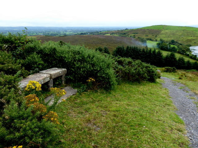 Photo could not load
H3145 : Stone seat, Topped Mountain
Kenneth Allen
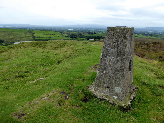 Photo could not load
H3145 : Cairn, Topped Mountain
Kenneth Allen
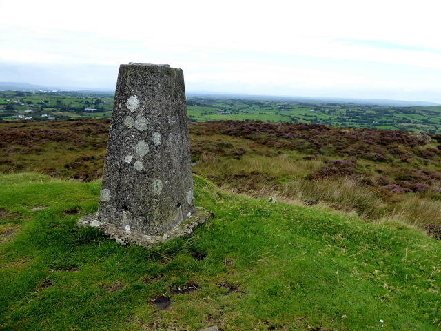 Photo could not load
H3145 : Cairn, Topped Mountain
Kenneth Allen
Hill facts and local notes
Classifications
Elevation
277m
909 ft
Prominence
131m
Coordinates
54.3590, -7.5224
H311457
OS Map
18
At the Summit
The summit features a prominent cairn, which has become a favourite spot for photos. There’s also a wooden post marking the highest point, as if to say 'Congratulations, you’ve made it!'
Terrain & Geology
Primarily composed of sedimentary rocks such as mudstone and sandstone, indicative of the region’s ancient marine environments. The area also features glacial deposits, adding a layer of intrigue to its formation.
Views & Scenery
From the summit, enjoy breathtaking views of the surrounding Southern Uplands and, on a clear day, the distant peaks of the Lake District.
History & Heritage
Name Origin
The name Mullyknock is derived from Gaelic, translating roughly to 'hill of the mound' which hints at its historical significance as a lookout point.
Historical Significance
The mountain has cultural ties to local folklore, often featured in stories shared by generations of hikers and climbers.
Getting There & Facilities
Check current local access restrictions, parking rules and transport timetables before travelling. These notes do not confirm public access to the summit.
Parking
A small car park located just off the A713 road, about 5 km from the nearest village, with space for approximately 10 vehicles.
Public Transport
Limited public transport options, best accessed by car. The nearest bus service operates from Ayr to village of Dalmellington.
Nearby Facilities
Dalmellington has a couple of cafes and public toilets, but it’s wise to bring your own refreshments for the hike.
Safety Information
Known Hazards
- Muddy sections after rainfall, potential for sudden weather changes, and steep drop-offs near the summit.
General Safety Tips
- Check weather conditions before setting out
- Carry appropriate clothing and equipment
- Let someone know your planned route
- Take a map, compass, and GPS device
- Carry emergency supplies: food, water, first aid kit, torch
Hills
Some common questions about the hills answered
Are there group walks up Topped Mountain [Mullyknock]?
Many walkers use Walkmates to join or organise walks with others. You can check for group walks around Topped Mountain [Mullyknock] through the maps
Are there other walkers around Topped Mountain [Mullyknock]?
Activity varies by location and time, but Walkmates lets you see whether others have shared walks or shown interest in this area. Find other people through the walking friends search walking friends for Topped Mountain [Mullyknock] search or of course create your own walk for Topped Mountain [Mullyknock]
Can I organise a walk to Topped Mountain [Mullyknock]?
Yes. If there aren’t any walks listed already, you can create a walk and make it available for others to join.
If you're signed up to Walkmates, you can create a walk to Topped Mountain [Mullyknock].
How do I find a walk up this hill?
There are often multiple ways to walk this hill, depending on experience and route preference. Walkmates helps you explore walks and routes that others have shared.
Can I suggest a new route up Topped Mountain [Mullyknock]?
Yes. You can suggest or create routes to share with others. Walkmates focuses on the social side of walking, so routes are used to help people organise walks and explore areas together, rather than as detailed navigation tools or route libraries.
Other uses really appreciate knowledgeable walkers sharing their routes. Share your favourite route to Topped Mountain [Mullyknock] here
The is an error or something incorrect about this hill. How do I let you know?
We always strive to keep the information on Walkmates as accurate as possible. If you find an error, please let us know through the contact form and we'll aim to correct it as quickly as possible
Community Discussion
Comments
Location
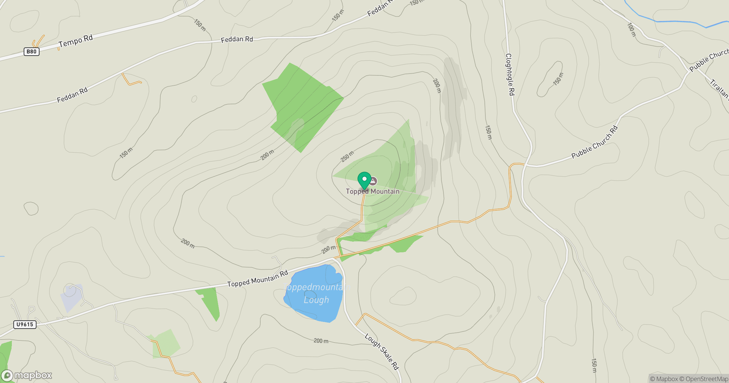
Grid reference: H311457
View on OpenStreetMapOpens a map in a new tab, centred on the hill.
Hills within 30 km
Straight-line distance, not a walking route or confirmation of access.
No comments yet. Be the first.